Summer 2026, fires on a scale never seen before
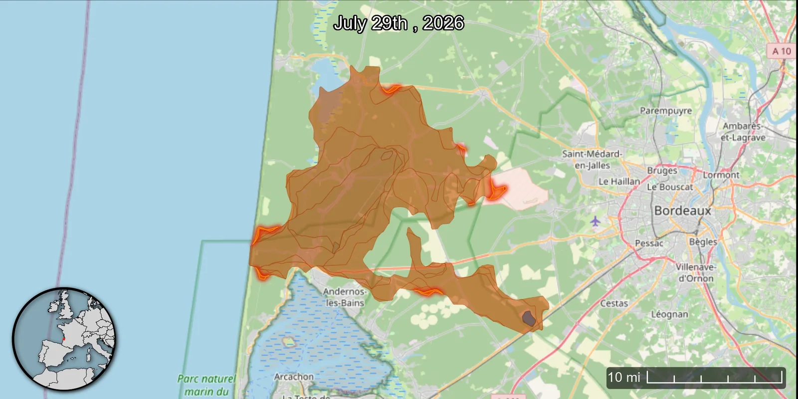
The fire perimeter on 29 July 2026, west of Bordeaux. The area covered stretches from Andernos-les-Bains to Saint-Médard-en-Jalles; the bright red lines mark the fronts still active. Map by NASA Scientific Visualization Studio, public domain.
Since the start of summer 2026, roughly 120,000 hectares of vegetation have been swept by fire in France, according to the provisional estimates released in mid-August. The previous annual record, set in 2022, stood at 66,300 hectares. We are close to double that, and autumn has not begun.
Two fires gave this summer its unprecedented, devastating scale.
On 12 July, fire broke out in the Fontainebleau forest. It was contained on the 15th, flared again briefly on the 29th, and was only declared out on 28 August. The toll: 2,050 hectares in a forest that millions of walkers know by heart.
On 22 July, another ignition, in the commune of Saumos in the Gironde. That one has no equal. The Gironde prefecture describes a fire that was "absolutely unprecedented in France": 240 kilometres of fire edge, 42,000 hectares of area covered, 252 buildings larger than 20 m² destroyed out of the 2,725 in the zone. More than 224,000 people were evacuated as a precaution. No civilian was killed or injured. More than 330 firefighters were.
The prefecture puts this intensity down to a combination of wind, temperature and drought, following three successive heatwaves.
Why the figures going round are not comparable
A detail that is anything but, and worth knowing before quoting a single hectare to anyone: area covered and area burnt do not measure the same thing.
The area covered is the operational estimate produced by the fire and rescue services, the one prefectures relay during the crisis. It is the firefighters' zone of intervention. It includes plots the flames spared.
The area burnt is what actually burnt. The European Effis system estimates it by satellite in near real time. The definitive measurement is surveyed by GPS with support from the French forestry office, then entered into the national BDIFF database. It will not be published until spring 2027.
The gap is far from trivial. Benoît Reymond, national fire expert at the forestry office, puts it at "around twenty percent" as a rule, sometimes far more: in the Corbières range in 2025, 17,000 hectares were announced against 11,000 hectares actually burnt. At Saumos, the prefecture announced 42,000 hectares covered while Effis estimated 37,500 burnt.
So bear in mind that no definitive figure for the summer of 2026 exists today, and be wary of any total presented without its date or its source.
There is a second reason for the gap, and it brings us to the subject of this article. Areas covered reflect the real work of firefighters, and when several interventions take place over the same ground, that ground is counted more than once. What brings crews back to a plot they have already dealt with has a name: rekindling.
What inflates the official count is precisely what a thermal drone exists to prevent.
"I was afraid of getting in the way"
In Clermont, in the Oise, Mathieu Parisse runs SOS France P.A.S., a company supplying equipment to rescue units. A few months before the summer, he fitted his business with a thermal drone and began offering aerial surveillance work. "It was the logical next step," he explains to France 3: "when you equip rescue teams on the ground, gaining height seemed obvious."
Then Fontainebleau burned.
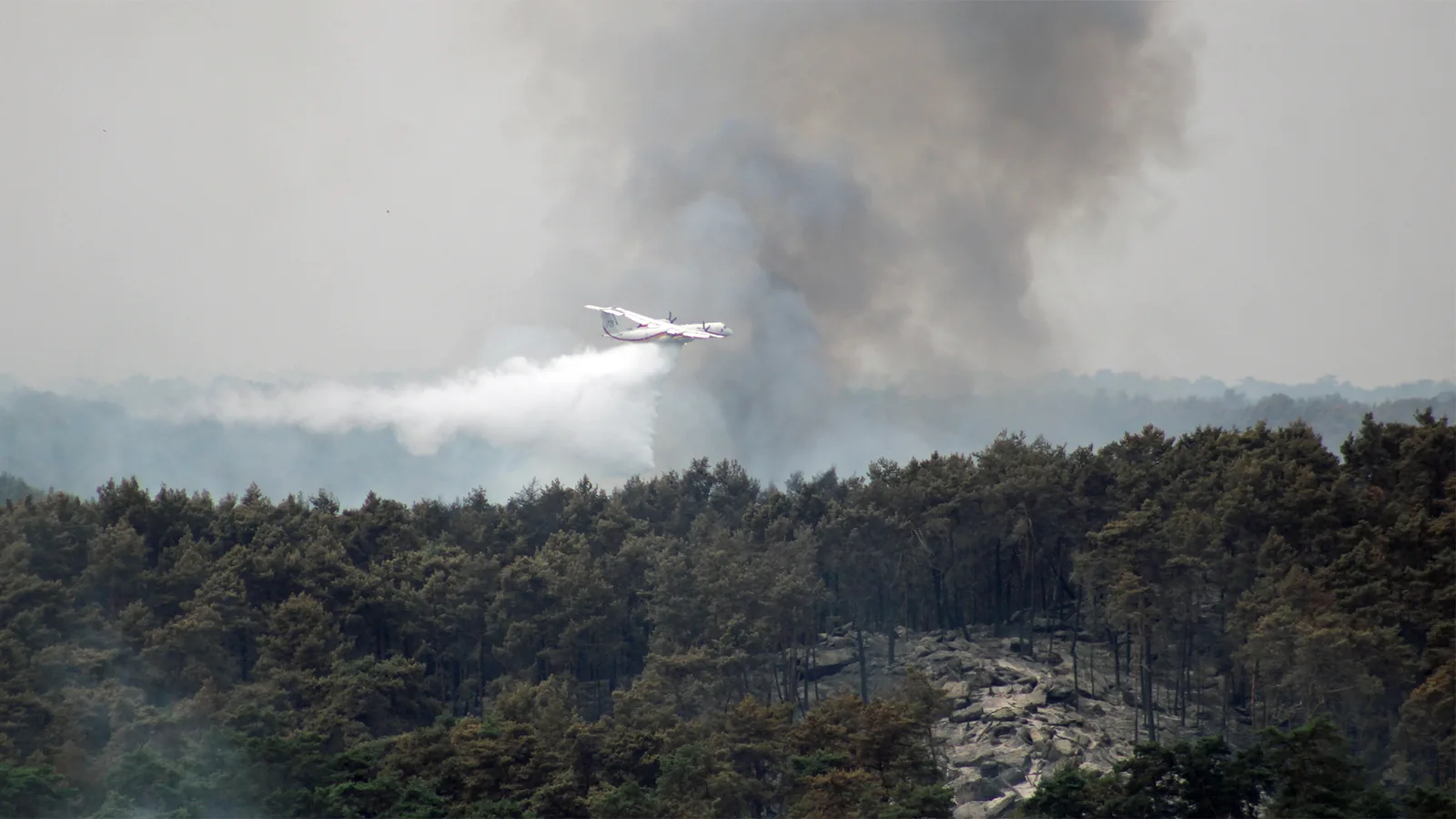
A drop over the Fontainebleau massif, 15 July 2026. Photo Baidax, CC BY-SA 4.0.
Faced with the scale of the fire, he decided to volunteer. What he says about that moment deserves quoting as it stands, because everything turns on it:
"I took it upon myself to offer operational support with the drone. I was afraid of getting in the way at first."
His offer hit home. The SDIS 77 quickly asked him to join the Grand Parquet sector, where he was folded into the drone surveillance setup already in place.
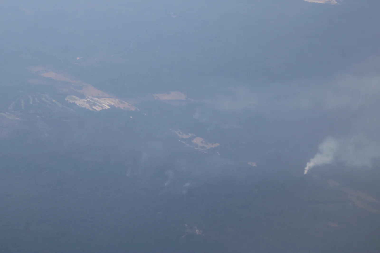
The massif seen from a plane on 16 July 2026: under the layer of smoke, several seats of fire are still giving off. Photo Baidax, CC BY-SA 4.0.
Once part of the setup, he decides nothing:
"Every time, I receive a mission and precise tasks to carry out. I don't act on my own."
Keep that sentence to one side. It is the most important in this whole article, and we come back to it below.
What a thermal camera sees that nobody else does
On site, Mathieu Parisse's method comes down to two flights.
First in standard vision, to observe the wisps of smoke and understand the geography of what is happening. Then lower, in thermal vision, to locate the hotspots. Those cannot be seen. Not from the ground, not from a helicopter, not with the naked eye from a drone.
The temperatures he records give the measure of it: 100 to 200 °C at Fontainebleau, and more than double in the Landes, where he measured beyond 400 °C.
A thermal camera does not see shapes, it sees differences in temperature. Ground that looks dead, black, cold, barely smoking, can hide underground embers just beneath the litter, smouldering without flame. One gust, or a few hours, is enough for that heat to find air again and set the plot alight.
That is rekindling. It is what calls firefighters back to where they have already been, what lengthens the day of an exhausted crew, and what has the same hectare counted twice in the tallies. And it is the one thing in the world a thermal sensor spots before it happens.
None of this is new, incidentally. At Fontainebleau, the forestry office has been using the thermal drone since 2019. Six volunteer foresters earned their remote pilot certificate there in June of that year and, a few months later, already had more than a hundred flights behind them. Their finding at the time has not aged: from the ground, between the vegetation and the rock chaos, visibility tops out at about twenty metres. With the drone, a seat of fire can be spotted up to 350 metres away.
In other words, the massif that burned in July 2026 was probably the best prepared in France on this technique. That was not enough to prevent the fire. It did help limit the rekindling.
You don't take off just because you own a drone
Now for what this article does not say, and it needs saying plainly.
It does not say you can grab your drone and go and help because there is a fire near you.
Read Mathieu Parisse's sentence again. He never intervenes on his own initiative on an operational site. He first contacts the rescue services deployed there to offer his help. He receives a mission. He carries out tasks defined by others. On a fire, that is the only way to be of use rather than a hindrance.
The reasons are brutally simple.
During the Saumos fire, a zone closed to civil aircraft, drones included, covered western Gironde and the northern Landes over a radius of about fifty kilometres, with a perimeter that shifted as operations went on. Such airspace closures are published by NOTAM and change from one day to the next: a map checked yesterday proves nothing.
Above all, a drone spotted near a fire grounds the rescue aircraft. The drops stop, the helicopters land, and the fire carries on meanwhile. The best-intentioned volunteer in the world then produces the exact opposite of what they came for.
And when the encounter does happen, it is expensive. In January 2025, above the Los Angeles fires, a recreational drone struck a Canadair CL-415 on a mission and put it out of service. Its pilot was sentenced to prison, plus 156,000 dollars covering the repair costs alone.
The rule therefore fits on one line. You offer, you wait for a mission, and you do not go without one.
A reserve of drone pilots, département by département
From his time at Fontainebleau, Mathieu Parisse draws a conclusion that goes beyond his own case.
"The idea isn't to replace firefighters, but to put the expertise of drone pilots at their service, so they can rotate, because I realised the fire services in some départements are very well equipped with pilots and others not at all. The Oise doesn't need it, for instance, unlike the Landes."
He put out a call for volunteers on social media. Pilots equipped with thermal drones declared themselves ready. That is how the Réserve Opérationnelle de Drones Thermiques was born, the RODT, an association still being formally set up.
It now brings together more than twenty volunteer pilots, each with at least one thermal-sensor drone, all holding the qualifications required to operate in sensitive areas. Around thirty are about to join, and close to 200 pilots have said they are interested. Its remit is narrow and clear: detect ignitions and zones of underground combustion, so water can be placed precisely before the fire spreads.
The association sets its own limit, and that does it credit: it is not there to replace the public rescue services, but to complement them.
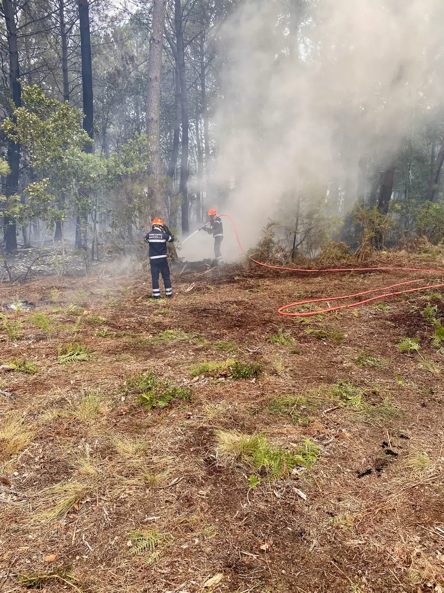
The Marseille naval fire battalion on the Biscarrosse fire, 25 July 2026. Photo Mikani, CC BY-SA 4.0.
Its first collective deployment took place on the Biscarrosse fire, in the Landes, where three pilots were pre-positioned together: Mathieu Parisse, Mike Crova and Karim Ziadé. Three professionals, three different companies, one shared coordination on a real theatre. In mid-August, Mathieu Parisse joined the Liège fire station to support the Belgian crews, a first for him.
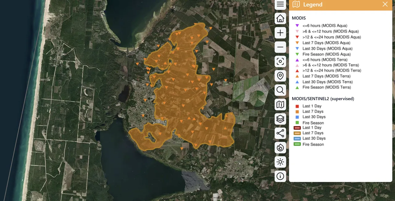
The burnt areas around Biscarrosse on 29 July 2026, as rendered by Effis. Map by the European Forest Fire Information System, CC BY 4.0.
Get ready now, not at the first ignition
The 2026 season is ending. That is exactly the right moment, because nothing that matters can be improvised in July.
| When | What |
|---|---|
| Autumn | Take or renew your certificate, check your insurance |
| Winter | Get thermal equipment if you haven't, learn to read the imagery |
| February to April | Introduce yourself to your local fire service, before it needs you |
| May to June | Declare yourself available, area by area |
| Summer | Offer, wait for the mission, never set off alone |
The most useful point on that list is the third, and it is the least technical. What the RODT found is a problem of territorial coverage: some départements have pilots in house, others have none. A fire service cannot call on someone it does not know exists.
Declare yourself, to volunteer
That is exactly the gap our directory sets out to fill. A service that needs a thermal drone in its area should be able to find one, by place and by speciality, without knowing anyone. Ticking the speciality takes a minute, and it is what brings you up when the request is about a fire rather than a roof or a vineyard plot.
- You already have a listing in the directory. Most operators are already there. Find it and claim it: claiming gives you control of it.
- You don't have an account yet. Create one, it is free, and the listing is built from your company registration number.
- In the app, open My organisation, section Activities. Tick Ecology & wildlife, then, under Sub-activities, Fire detection support. If you also work after the fire has passed, Post-fire assessment is just below.
⚠️ It is open, and it is in beta. You can declare yourself whether you are a professional, a public service or a private individual.
⚠️ For a private individual or a public service, this declaration stays private: it appears in no public list. Only professionals appear in the directory. You can also declare yourself unavailable for a period without unsubscribing from the service.
And if you are a fire and rescue service, or a local council, the search works the other way round: describe what you need, and the equipped pilots in your area answer.
Finally, if you are a certified pilot with a thermal drone and this speaks to you, the reserve is recruiting. The link below goes straight to them, we expect nothing in return.
Sources
- Gironde prefecture, situation updates on the Saumos fire, July and August 2026
- France 3 Hauts-de-France, "Drones minimise the risks for firefighters", 15 August 2026
- franceinfo, "Area covered, area burnt: why the figures going round differ so much", 13 August 2026
- Office national des forêts, "The thermal camera drone, the forestry office's new ally against fire", 2019
- Réserve Opérationnelle de Drones Thermiques, association presentation
- Effis, European Forest Fire Information System, satellite estimates 2026